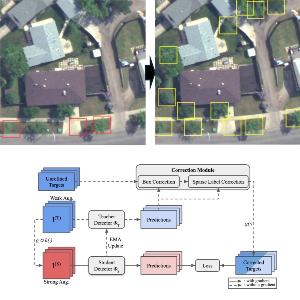
Remote Sensing with limited Ground Truth
The area of remote sensing yields an abundance of multi- or even hyperspectral imagery. However, mapping these measurements to real spatial places or events is difficult and thus, ground truth is generally sparse. In this project, we examine imaging methods which require a minimum amount of ground truth.

